Chapel Hill Trails
1) Morgan Creek: Parker to Merritt's Pasture
|
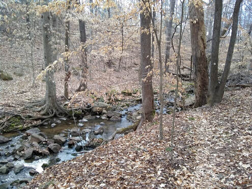
Morgan Creek runs from University Lake to the northern arm of Jordan Lake. There are a number of short trail segments that I like to connect.
Start on Parker Road where it turns into a dirt road. Halfway down the dirt section is a trail head on the right. Note there is a fence at the end of Parker - this is trail was formalized in 2021 and is now a now a "normal" trail. The trail will descend to the Mason Farm Biological Reserve, where there are numerous bird watching stations. At the end of the Mason Farm trail, pass over Morgan Creek to the parking area. Turn left on the gravel road (Finley Golf Course Road), and left onto Old Mason Farm Road. Just before the driveway entrance to the UNC Botanical Gardens are the garden's trails. Follow these trails around the rear of the gardens, heading south-west. Take Oak Hickory Trail to Elephant Rock trail (stop by the elephant rock). For those who must remain on a developed / maintained trail, your journey will end here. Once you hit the creek, head west (right facing the creek). Eventually the trail ends and you end up on OWASA easement. Stay close to the creek, and do not take any of the side paths. Unfortunately this requires crossing the creek via OWASA lines. There is one section where the landowners have placed "No Trespassing" signs; at this point cross the creek itself to get on the south side of the creek. At the end of the OWASA easement is Merritt's Pasture. Most people end their trip here, or at the new entrance to the paved greenway path. The trail extends via a rough dirt road to Smith Level road. This area known as "South Side" has side trails that go towards Culbreth Rd and Smith Level. |
|
2) Chapel Hill Campus to Garden Trail AKA Pinetum
This has to be the most unused trail in town. The purpose is to connect UNC main campus to the Botanical Garden, however I can't imagine many students actually use it to travel between campus and the gardens. It's relatively quiet, however traffic from Manning and 15-501 will interrupt your peace. Make sure to follow the creek to the drainage pipes - after rain the drainage pipes sure push a lot of water out!
3) South Side
I have no clue if this is the actual name. I doubt there is a name for this trail...and it's not really a trail. It becomes a trail when the local mountain bikers clear the leaves and branches (thank you!). To get there, find the water tower at the end of Raintree Lane, and go explore.
If you make it to the bottom of the trail & to Chase Park Apartments, you can continue across Hwy 54 and explore the west end of Morgan Creek. From the formal concrete parking lot off 54, go in the opposite direction of most people and head west.
If you make it to the bottom of the trail & to Chase Park Apartments, you can continue across Hwy 54 and explore the west end of Morgan Creek. From the formal concrete parking lot off 54, go in the opposite direction of most people and head west.